Iceland – the clue is in the name, though to clarify things a little further, they do call it the land of fire and ice. Today we spent most of our time with the latter. The moniker is very apposite given that around 11% of Iceland’s total land area is covered by glaciers. The largest is Vatnajökull – the suffix jökull means ‘glacier’ – and its ice cap is up to 1km thick in places. In fact it is this glacier that gives its name to the National Park – Vatnajökull National Park. This is the largest of the three national parks in Iceland, having expanded out to incorporate national parks previously existing at Skaftafell in the southwest and Jökulsárgljúfur in the north. It encompasses 14% of the land area of Iceland.
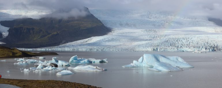
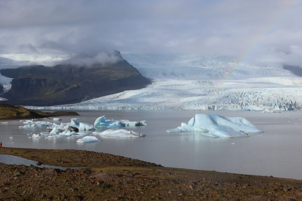
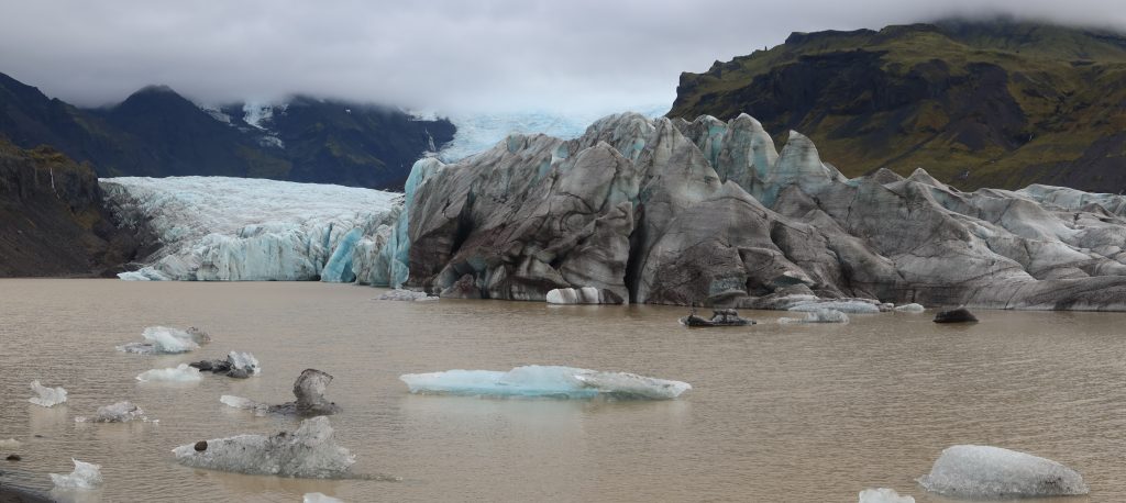
Not surprisingly then, much of our day was spent driving around it to the south, stopping at various places. The first stop was at Jökulsárlón glacier lagoon. Jökulsárlón translates to “glacial river lagoon” and it does what it says on the tin. It is a large glacial lake (in fact the largest in Iceland) at the head of the Breiðamerkurjökull glacier and like all glacial lagoons, it is formed when the glacier starts receding. In the case of Jökulsárlón, this was in the late 19th century. Unsurprisingly, the lake is now expanding quicker as the glacier recedes and the glacier front is now over 8km from the ocean. The appeal of the ice lagoons is the icebergs floating in the lake – well not really floating as they are all aground and melting! They actually melt quite quickly as they meet the warmer sea water and are then gradually washed out to sea, but they are topped up by new icebergs calving from the glacier. A treat was seeing seals at the entrance to the lagoon as we walked in from the car. They feed on the arctic char and other fish in the lagoon.
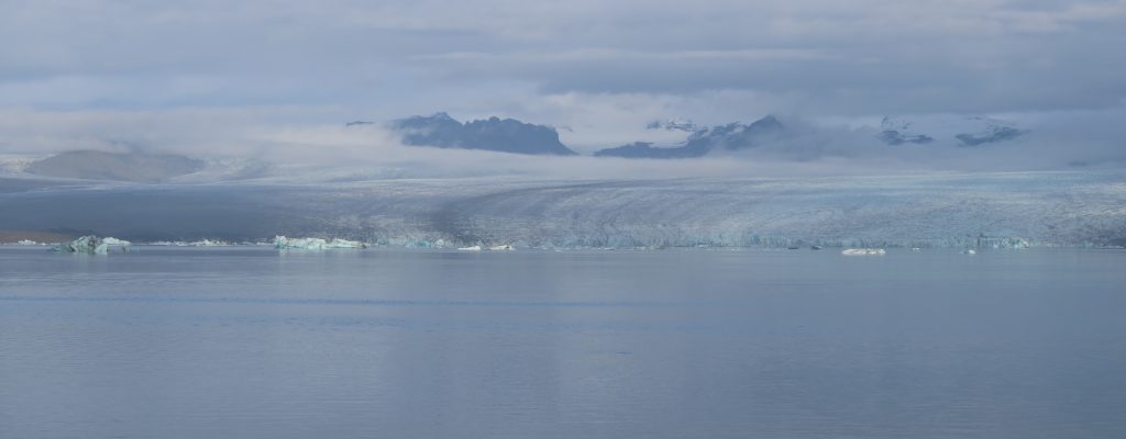
Jökulsárlón is one of the busier lagoons, so next we headed to what was said to be a quieter one – Fjallsárlón glacier lagoon. Sure enough, it was a lot quieter and more importantly, you could get a lot closer to the glacier. Glaciers are obviously ice (derrr …!), but that belies the incredible variety of shape and colour in them. Some of the ice will appear blue and this is where the ice is deep, compressed ice. As a result the air has been squeezed out and so light penetrates, is absorbed, and then scatters blue wavelengths. If this deep dense ice is not there, then the ice will appear white or perhaps grey or black where it has absorbed debris from the moraine in its passage down to the lagoon.
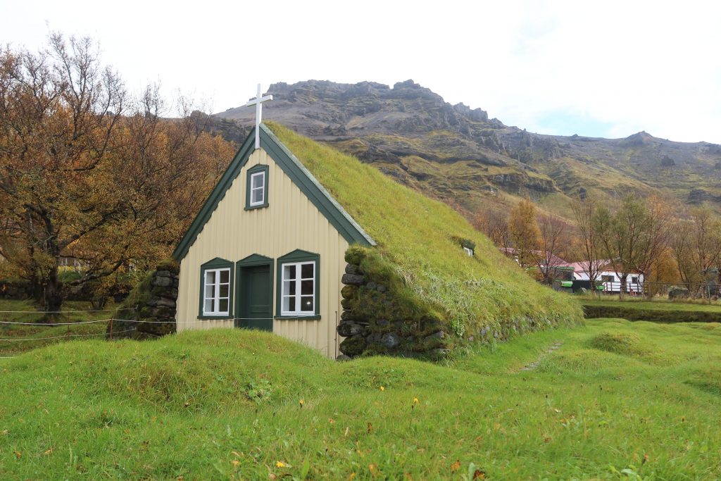
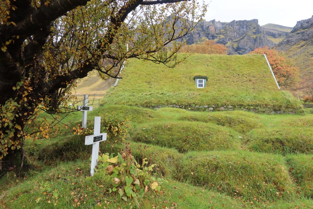
The next stop was a short but intriguing one – Hofs Church. There has been a church at Hof in Öræfi for 700 years (the first written records are from a cartulary (an old medieval document) from 1343), but the current church was built in 1883-1885. It is one of only six turf churches remaining in Iceland and is a protected monument, owned and maintained by the National Museum of Iceland. The walls are rock and the roof is stone slabs which are then covered with turf. Outside the church are mounds of turf and these are the gravestones.
After this turf diversion, it was back to ice with a visit to the Svínafellsjökull glacier – you can never visit too many glaciers in a day. In fact this glacier tongue is famous – it has appeared as a film location for Batman Begins, but far more importantly it represented the area north of the wall in season 2 of Game of Thrones.
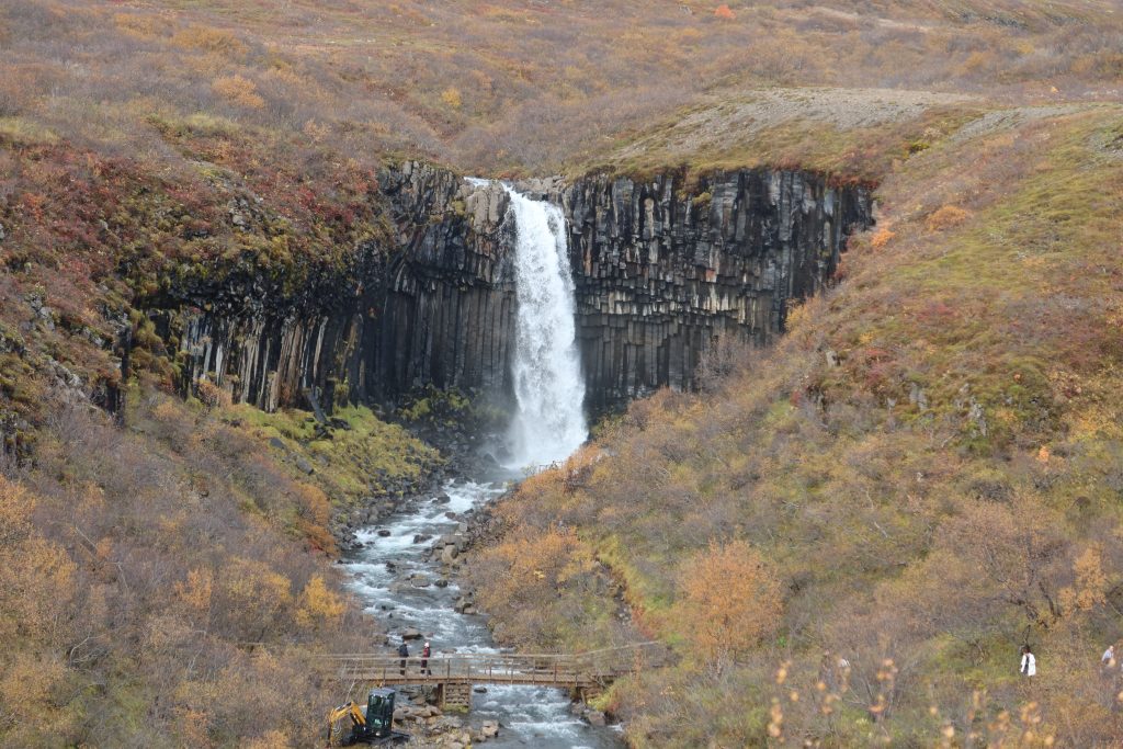
A logical next step in Iceland is to visit a waterfall. When glaciers in the snow cap melt, the rivers run down to the sea and where they encounter the softer sedimentary rock, it erodes away often leaving the harder volcanic rock base. In this case a waterfall may well be the result. The waterfall we chose to visit was called Svartifoss on the southern edge of the National Park (the area which used to be Skaftafell National Park). The name Svartifoss breaks down to Svart (‘black’) and foss (‘waterfall’). The reference to black is because of the surrounding basalt columns. These are hexagonal in shape (like the Giant’s Causeway and so on) and are common in volcanic regions. They form from slow cooling and contraction of thick lava flows. This causes the basalt to crack into hexagonal shapes. The reason they are hexagonal is because this is the most efficient way to relieve the stress created as it shrinks. Cracks start at the top surface of the lava and propagate downwards, making the columns perpendicular to the cooling surface. These columns were obvious at the waterfall.
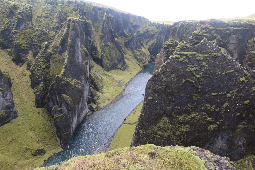
The final stop of the day (we were really cramming it in today!) was Fjaðrárgljúfur canyon. This is a steep river canyon with the Fjaðrá river flowing through it. It is up to 100 metres deep and runs fro just over a mile through the rock. The shapes and patterns formed by the erosion of the river were at times quite surreal. Its origins are from the last Ice Age over two million years ago when the river started eroding the rocks and palagonite, gradually forming what we see today.
It seems though that we were lucky to be able to visit it. In 2019, the park authorities closed the canyon to visitors after it appeared in the music video for Justin Bieber’s “I’ll Show You“. The swarm of visitors resulting from this threatened to damage the canyon’s natural environment. Who knew Justin Bieber was so influential!
From there we drove past Vik and on to Sólheimahjáleiga Guesthouse – around 40km to the west of Vik. A quiet evening and lovely supper of locally farmed Arctic Char washed down with an Icelandic beer flavoured with thyme finished off the day perfectly.
P.S. The Justin Bieber video does actually give quite a nice flavour of what this section of coast is like! Click away now if you want to avoid see Justin Bieber 😉
Leave a Reply