Today we had a chance to explore further the Golden Circle. This is an area between Gulfoss and the Reykanes peninsula with a series of what might be regarded as iconic Icelandic tourist destinations. The main stops are Þingvellir National Park (pronounced with a ‘th’ – Thingvellir), Gullfoss waterfall, and the geothermal area in Haukadalur. Sometimes included in tours are other attractions like the Blue Lagoon, but these are the main sights. As a result, they can be busy, even in October!
We knew it was going to be busy so started fairly promptly and headed straight to Þingvellir National Park. We seemed to have timed it right in that there were still parking spaces and so we parked quickly and stuck our heads into the National Park office asking the guide manning the counter the same question he probably gets asked every day several thousand times. Unsurprisingly he has a well-rehearsed answer, but perhaps more surprisingly delivered it in a very friendly and helpful way. Perhaps being there early means you get them while the day is still fresh. It must pale quickly when you are answering the question for the hundredth time. So, with this helpful advice on a suitable walk, we set off to try and beat the crowds. We started at the observation deck they have built by the information centre which gives an excellent view of Þingvallavatn, the largest natural lake in Iceland and part of the National Park.
The name Þingvellir is derived from the Old Norse Þingvǫllr from þing (“thing, assembly”) and vǫllr (“field”), meaning assembly fields. This in turn comes from Alþing (Althing) which was the national parliament of Iceland. This was founded at Þingvellir in 930 and held its sessions there for many centuries until 1798. This linguistic origin can be found in many other countries – Dingwall and Tingwall in Scotland, Thingwall in England, Tynwald on the Isle of Man, Dinklage in Germany, and Tingvoll in Norway are all names with the same root and meaning. The word thing is a form of assembly found in many Germanic societies and survives in various forms throughout Northern Europe.
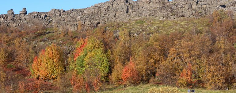
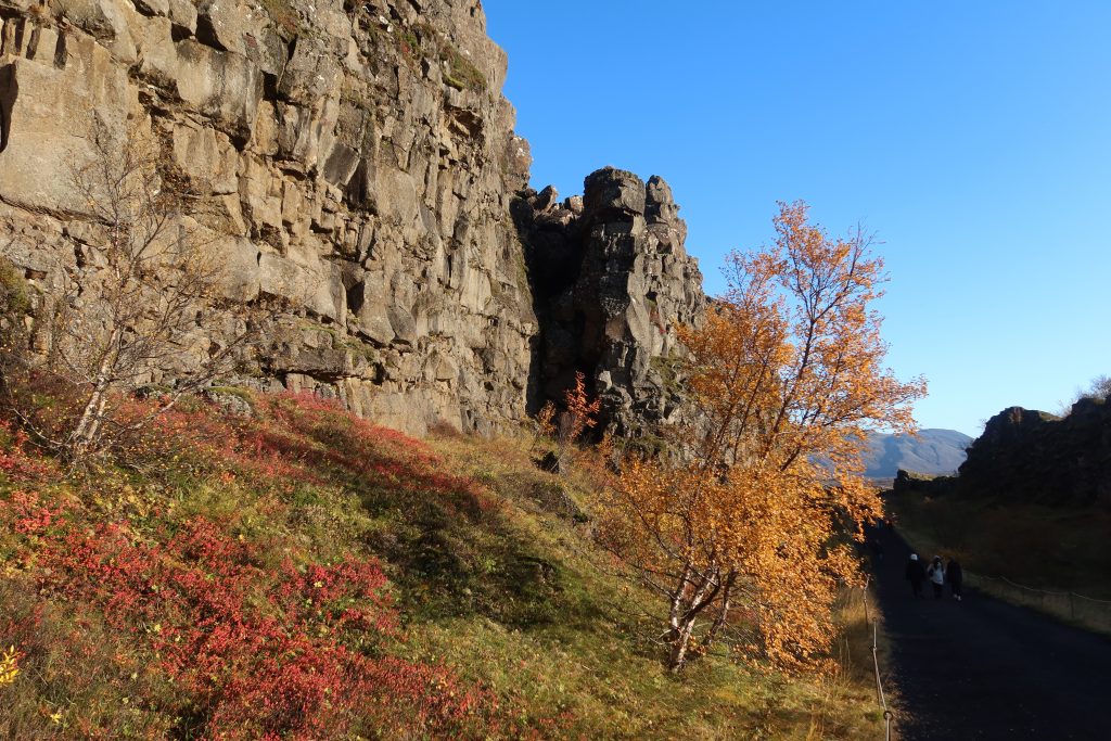
The initial part of the walk is effectively a walk along the edge of a tectonic plate. The site marks the boundary between the North American and Eurasian plates and the drift of the plates is evident in the cracks and faults in the rocks around. For locals, it is also evidenced by frequent earthquakes. This fact alone perhaps makes it a surprising place to find Iceland’s supreme legislative and judicial authority. This was known as the Alþingi (assembly) and was located at Þingvellir from its establishment in 930 until 1271.
A part of the site is a rock area known as the Lögberg (Law Rock). The Lawspeaker would annually stand on the rock and, before laws were written down, recite the laws of the land. He (it was always a ‘he’!) had to recite this from memory and would be elected for three years at a time. This assembly acted as the Parliament and also the Supreme Court of the land. Punishments were also, for many years, carried out in the area. These were made more severe after ‘The Great Edict’ of 1574 – this concerned offences like incest and fornication and responsibility for sentencing and punishment moved from the church to the secular authorities. They took up this new role enthusiastically – partly as a deterrent to people to avoid offending – and in the most serious cases men were beheaded and women were drowned. This was done in a pond in the river just down from the Alþingi.
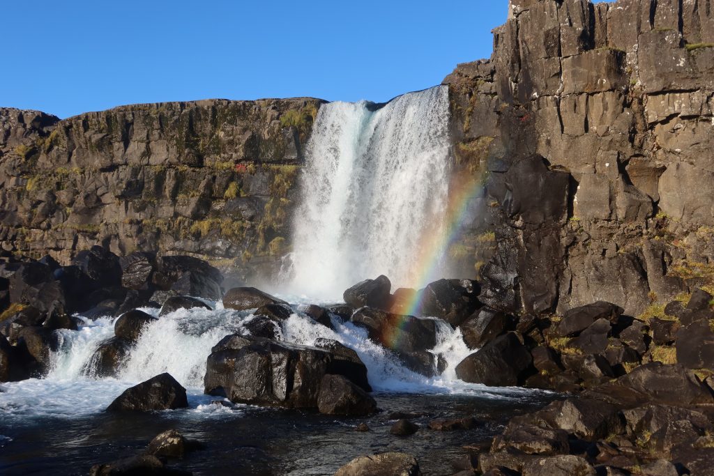
From there we carried on walking to the waterfall on the river Öxará. This traverses the national park and forms a waterfall at the Almannagjá – the waterfall is called Öxarárfoss.
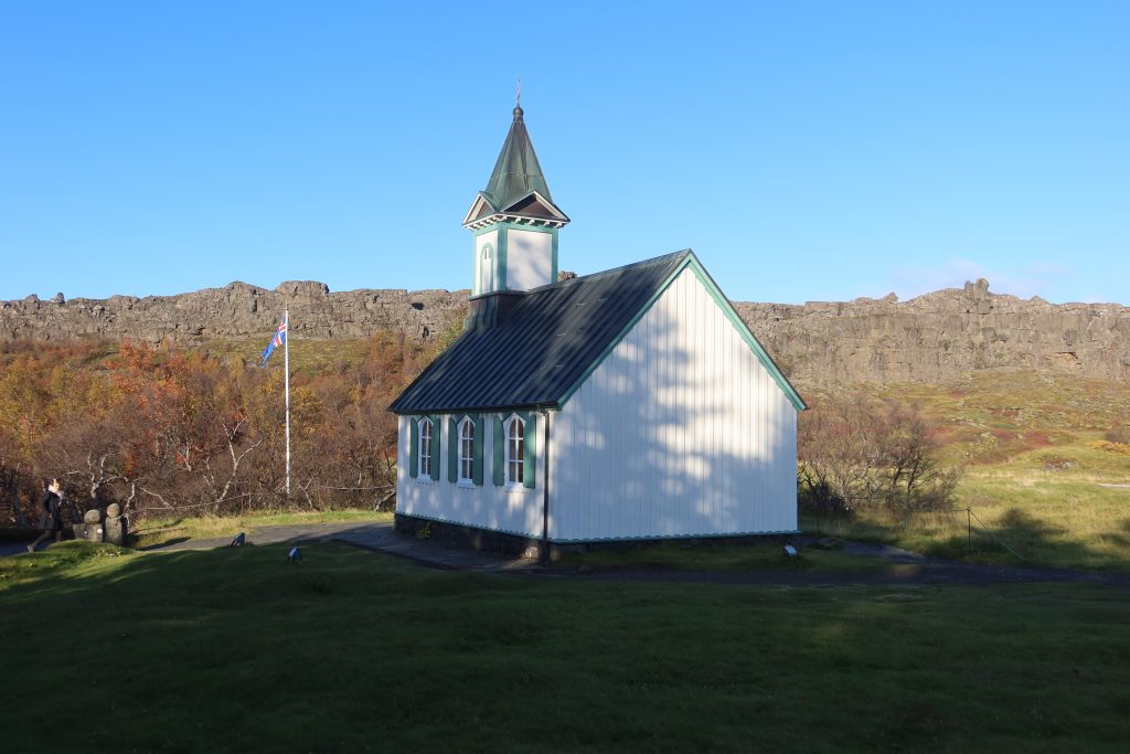
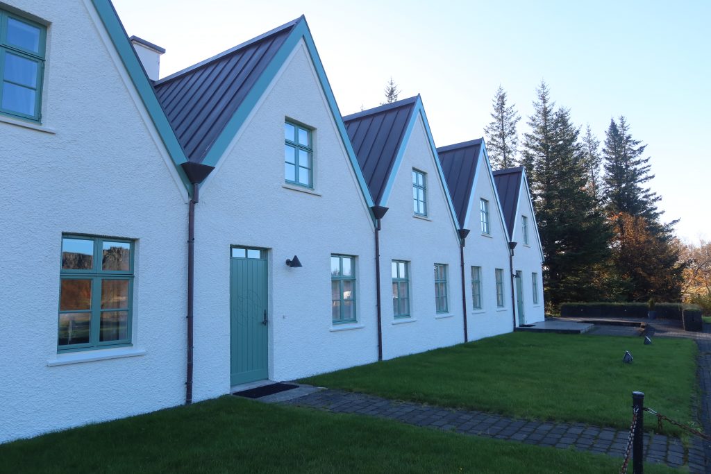
The walking loop then takes you across the river over to Þingvellir church and a row of small cottages. These are government summer houses and, given the unique status of Þingvellir, these are often used by senior government officials. In 1970 Bjarni Benediktsson was the prime minister of Iceland and he died in a fire at these houses on 10 July 1970. His wife and grandson also died in the fire. They have since been rebuilt and they are now the Prime Minister’s official summer residence.
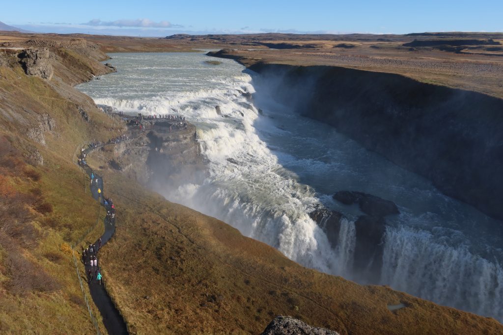
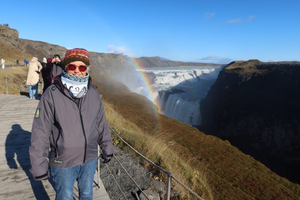
From Þingvellir we headed to the outer extremity of the Golden Circle – the Gullfoss waterfall. This waterfall is on the Hvítá river and at Gullfoss it turns sharply to the west and flows down into a wide curved three-step “staircase”. It then abruptly plunges down two stages ( the first is 11 metres in height, and the second 21 metres) into a crevice 32 metres deep. Vast amounts of water flow over the falls – in the summer around 141 cubic metres per second and it is seriously impressive. As with any powerful and plentiful resource of this nature, there have been attempts to monetise it. Right up until the late 20th century there have been attempts to use the falls to generate electricity and during this period, the falls were rented to foreign investors. For various reasons, partly related to a lack of funds raised, these attempts failed, but Sigríður Tómasdóttir – the daughter of the co-owner – should also be credited with preventing this exploitation. Her dedication and advocacy for legal protections against foreign control of it certainly helped raise the profile of the cause. Indeed, she regularly threatened to throw herself down the falls. She is rightly memorialised by a stone memorial above the falls.
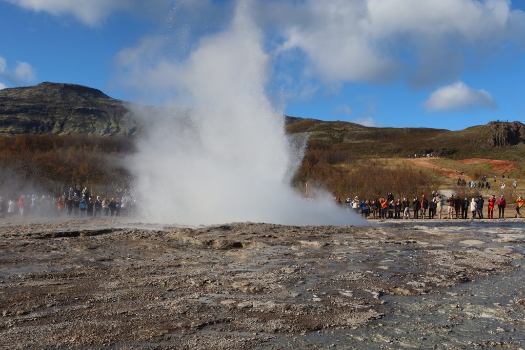
From Gullfoss we headed to the last stop of the day – the Haukadalur valley. This is a geo-thermal area – indeed, arguably it is the most famous geo-thermal area given that its most famous geyser is called Geysir – the name we now give to this phenomenon of heated waterspouts. The Geysir geyser is now dormant, but there is now active one called Strokkur which goes off every 5-10 minutes. Unsurprisingly, it is constantly surrounded by people and cameras, all waiting for it to suddenly go off. Once it does, there is a rotation of people and cameras all waiting for the next one and then another rotation of cameras and so on …… The Strokkur geyser is thought to have started spouting in around 1789 when an earthquake unblocked it and in 1815 is thought to have been around 200 foot high. However, at the turn of the 20th century, another earthquake blocked it again. In 1963 locals drilled though the blocked conduit and it has been erupting ever since.
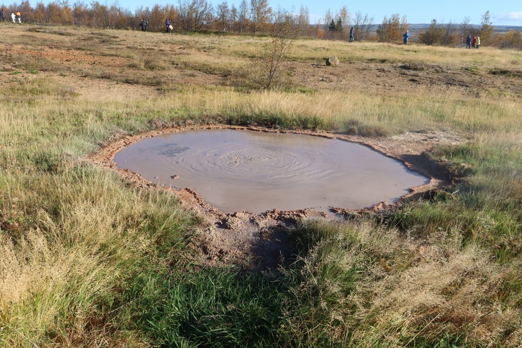
Just as interesting are the ‘smaller’ features of any geo-thermal area, things like boiling mud pools and fumaroles (vents), but there are other smaller features as well.
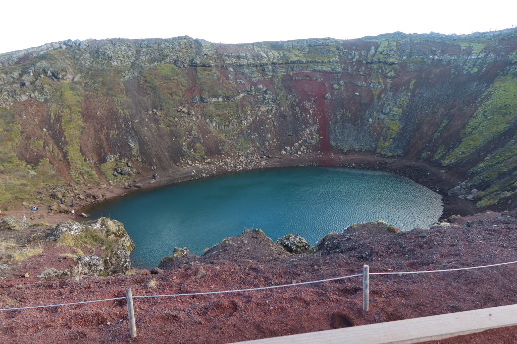
A final stop was the Kerið crater. This is the northernmost of four craters located along an 800-meter fissure called the Tjarnarhólar. The crater seems to fit perfectly our perception of what a crater should look like – an almost perfect sphere with a relatively steep slope straight down into it and a spherical lake at the bottom. There is a short walk right round the crater and it is possible to descend down a path into, but we figured that what goes down has to come up again, so we stayed at one level – the top! As with everything so far today we had to pay a fee, but this one offered us free (limited) parking – we simply had to pay to get into the site. All the other sites we have had to pay for the parking instead! The land the crater is on is now owned by a private company – Arctic Adventures – so the fee goes to them ….