This morning we left Camperdown and headed south back towards Port Campbell. Driving along I had the song ‘Camptown Races’ as an earworm – not quite the Camperdown Races, but Camperdown did have a racecourse and if you sing it badly enough the words do fit with Camperdown ….. It passes the time!
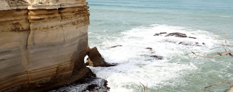
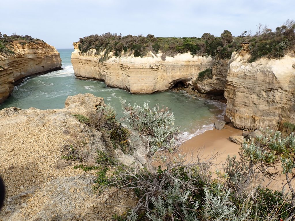
Once back at Port Campbell (where we left the Ocean Road a couple of days ago) we headed east and out first stop a few miles later was the Loch Ard Gorge. The name makes it sound like this was named by some homesick Scotsman who had moved to Australia, but the story behind the naming is much more tragic than that. The gorge is named after a ship called the Loch Ard. She was sailing from England to Melbourne in 1878 and a navigational error in fog meant that they were far too close to the coast. When the fog lifted at 4am they saw breakers ahead and tried to come about to get clear, but they were too late. She struck a reef off the coast and of the 54 people on board, only 2 survived. The two who survived – Thomas Pearce and Eva Carmichael were washed ashore in the gorge and Pearce climbed the cliffs to get help, saving Eva Carmichael’s life. She returned (on a steamship!) to Ireland. The ship was carrying various luxury goods and some have been recovered on dives on the wreck, but apparently a grand piano washed ashore in the gorge. History doesn’t recall whether it was playable after its immersion!
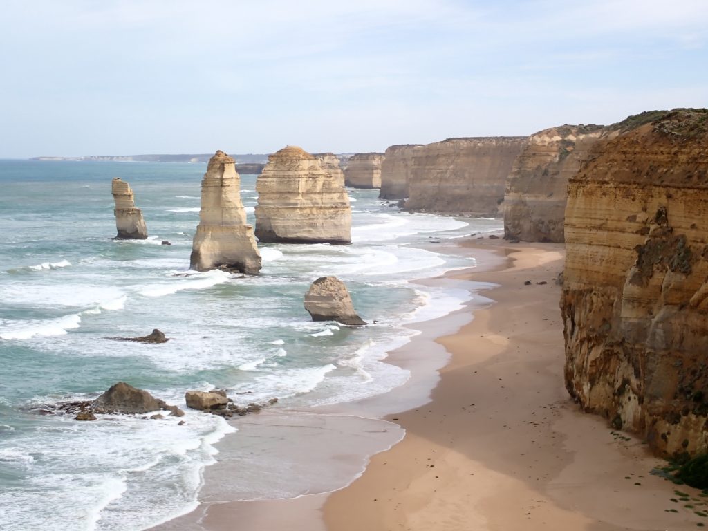
From there we went on an Apostle hunt. A few miles further down the road are the Twelve Apostles, or … more correctly now, the Seven Apostles. Five of them have collapsed, a fact which changed my earworm to the song “10 Sandstone Apostles were standing in the sea ….. and if one sandstone Apostle should accidentally fall ….“. With this sacrilegious thought we drove down to the main car park. This looked pretty full (it was the Labour Day holiday) so we carried on to Gibson’s Steps. These are steps down to the beached carved into the rock. It is thought that the Kirrae Whurrong people, originally carved the steps to access the beach, but the steps are now named after the Pioneer Hugh Gibson. He built the nearby Glenample Homestead and apparently regularly used the carved steps to access the beach below. This homestead was where the survivors of the Loch Ard shipwreck stayed to recover. So, after negotiating a busy car park and some parking rage (!), we walked down the steps and traced two of the 12 apostles. It turned out that the other 5 were round the other headland, so we headed back and finally hunted down the rest of them.
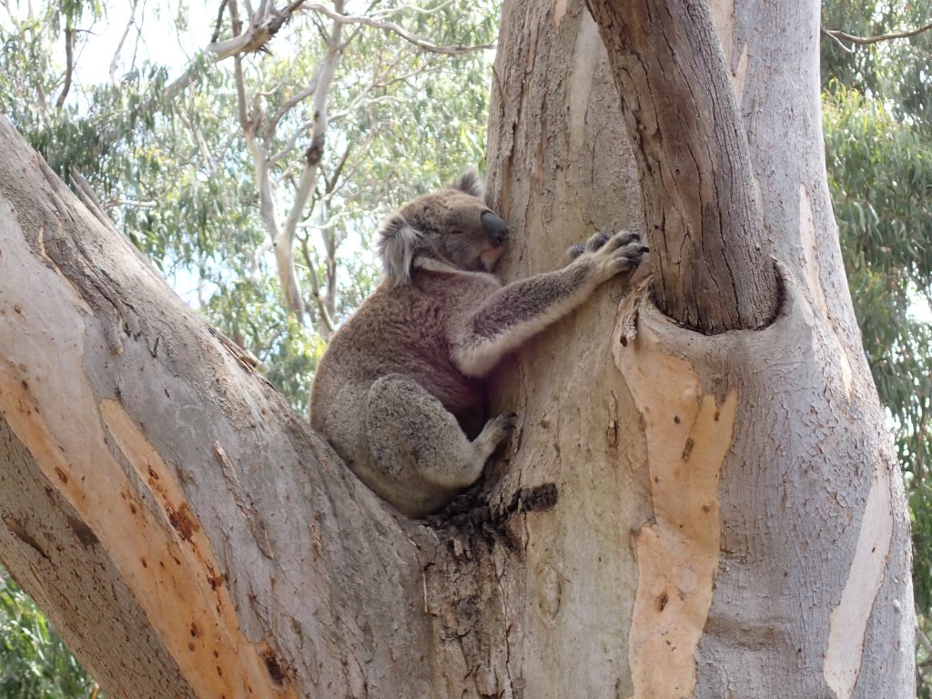
Once we were apostled out, we decided to head over to Cape Otway. We were booked into a campsite on the Cape Otway headland and so headed over there to check in. We were pleasantly surprised to be sharing the campsite with a number of koalas, one draped elegantly across the branch just behind our campervan.
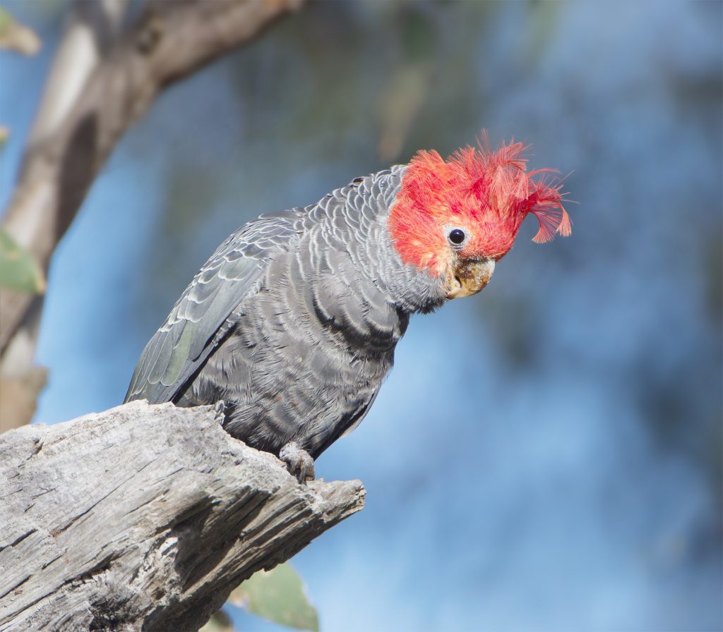
Another of our companions on the campsite was the gang-gang cockatoo. This was identified for us by someone camped close to us and the name is probably onomatopoeic, though she described the call it makes as like a creaking door which made it easy for us to mark it out. The gang-gangs like coastal areas and are limited to coastal regions of south-east Australia. They used to inhabit King Island off Tasmania, but are now extinct there. They have been introduced onto Kangaroo Island, but despite all this, they are listed as a threatened species, so we were lucky to see quite a few of them cavorting around the campsite ….
Our final trip for the day was to head down the headland to see the Cape Otway lighthouse. This has a famous, or perhaps even infamous history. Arguments and politicking between New South Wales and Van Diemens Land governments led to prevarication and delays on an industrial scale. They all knew that a lighthouse was required, but each argued about who should be responsible and pay for it. The issue was that the Bass Strait had only recently been discovered as a route through to Sydney and Hobart and after months at sea, the skippers had to thread the needle between Cape Otway and King Island. Any errors in their position could be, and frequently were, fatal. It was only when the British declared that it was too dangerous to use the Bass Strait and told ships to go south of Tasmania that the politicians finally saw sense and started to build the lighthouse. It was completed in 1848 and undoubtedly saved many lives. The start of the Victorian Gold Rush not long after cemented the position of Melbourne as a port and in 1850 Victoria was proclaimed by an Act of Parliament as a separate state.
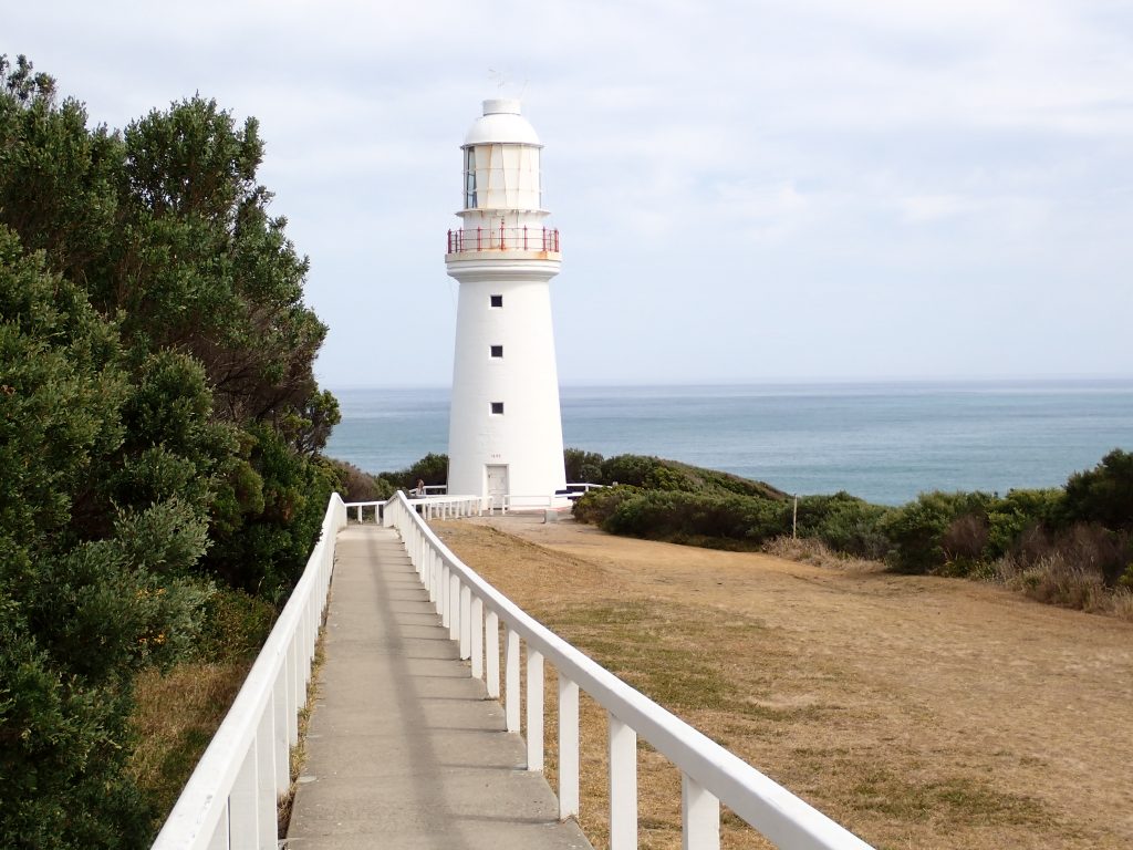
The area also played an important role in World War II as a radar and signalling station – particularly to combat the threat from Japanese submarines.